About Calape Bohol
Calape, Bohol · Philippines

The Story of
Calape

A municipality whose name, origins, and development are documented across centuries of colonial accounts, local records, and historical research.

Calape · Bohol · Philippines

The Story of Calape

A record of the municipality’s name, origins, and history, drawn from official land use documentation, colonial-era accounts, and the historical memory of its people.
Calape Bohol ◈ Calape, Bohol

Why Is It Called Calape?

“CA’PE” · “CAPE’” · “CALAPE”

According to the Municipality of Calape Comprehensive Land Use Plan 2018–2027, Calape ranks as the 24th largest municipality out of 47 in Bohol Province by land area. Historical accounts indicate that when Spanish nationals arrived in the locality, they encountered a well-established community of native villagers already settled in the area.

Local historical record preserves two accounts of how Calape received its name. The first attributes the name to a plant species of rattan called “CA’PE,” recorded as abundant in the area at the time. The second account traces the name to a different plant species, “CAPE’,” documented as the source of a local beverage that continues to be cultivated in the municipality.

Records indicate that, over time, both forms — whether “CA’PE” or “CAPE’” — converged into the name CALAPE, the designation that has been retained by the municipality through successive administrative periods to the present day.

A Journey Through Time

The History of Calape

Pre-1565
A Well-Established Community
Archaeological and historical evidence indicates that this area was inhabited well before the arrival of Spanish colonizers. Prehistoric artifacts recovered from caves across Bohol confirm that the island’s earliest inhabitants were of Shri-Visaya Malay descent, having migrated from Cebu, southern Negros, and neighboring islands. By the time Spanish nationals reached these shores, a well-established community of native villagers was already settled in the locality.
1595
Jesuit Mission Established
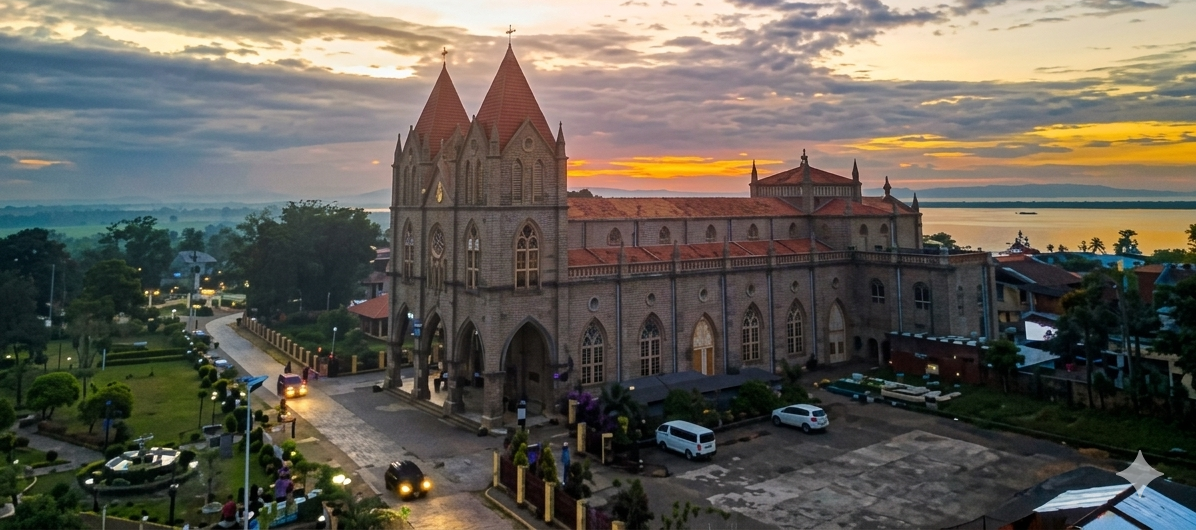
In 1595, Bohol was designated a Jesuit mission under Spanish colonial administration. At the time, the island was governed as part of the province of Cebu and classified as a residencia. Ruins of public and private buildings constructed in Spanish architectural style remain in the area today, documenting this early period of colonial settlement.
1802
Creation of the Town of Calape
Records date the formal creation of the town of Calape to 1802, during the Spanish colonial period. Documentation from this period remains incomplete, and the identities of the town’s founders are not recorded. Its earliest known inhabitants included the Marapao family of Loay, the Salomon family of Loon, and the de la Serna family of Dumanhug, Cebu, among others.
1854
Politico-Military Province
On July 22, 1854, Bohol was declared a politico-military province under Spanish rule. By 1879, the province comprised 34 towns, with Calape recorded among them. Administrative authority over the province rested with the Spanish Governor of Cebu, who formally declared Calape an independent town of the province.
1899
American Colonization
American forces landed in Bohol in 1899 by way of Tubigon, Calape’s neighboring town, with the stated objective of suppressing insurgency and establishing American sovereignty over the island. Remnants of General Emilio Aguinaldo’s forces remained active in Bohol at the time. Local accounts record that a Roman Catholic priest, Father Felimon Urbeta, successfully petitioned insurgents to spare the bridge at Barangay Desamparados from destruction.
1942
Japanese Occupation
Japanese military forces occupied Calape in 1942, during the Second World War. Historical accounts document widespread mistreatment and killing of civilians, destruction of property, and the arrest of individuals suspected of guerrilla activity. On Pangangan Island, USAFFE soldiers — including Captains Francisco Solis and Lt. Valentin Estrada, among others — were captured and executed by the Japanese “Kempei-tai.”
Post-1945
Liberation & Reconstruction
Following three years of occupation, American forces under General Douglas MacArthur liberated the country. The withdrawal and surrender of Japanese forces left widespread destruction, which residents addressed in the years that followed. Trade resumed as inhabitants sailed to Leyte and Samar to exchange goods, and US war damage claims contributed to the town’s gradual economic recovery.
1990s–Today
A Progressive Coastal Municipality
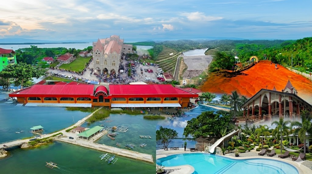
From the early 1990s onward, Calape underwent sustained infrastructure development, including the construction of farm-to-market roads, bridges, schools, and health centers. The municipality is recognized today for its coastlines, marine biodiversity, and growing eco-tourism sector, with Pangangan Island — home to the Our Lady of Lindogon Shrine — regarded as its most notable landmark.

Calape at a Glance

Calape by the Numbers

📍
Location
Bohol
Northwestern coast of Bohol Island, Central Visayas, Philippines
🏛️
Founded
1802
Formally established as a municipality of Bohol Province
Patron Saint
St. Vincent Ferrer
Celebrated every May 10 — Town Fiesta of Calape
🌊
Crown Jewel
Pangangan Island
Home to Our Lady of Lindogon Shrine and stunning coastal views
🗣️
Language
Cebuano / Visayan
The primary language spoken by the people of Calape
🌿
Known For
Eco-Tourism
Beaches, forest trails, marine life, island hopping, and heritage sites

Northwestern Bohol, Philippines

Where is Calape?

Getting to Calape

Location & Directions
  • 📏
    Distance from TagbilaranApproximately 41.4 km via the Bohol Circumferential Road
  • 🚌
    By Bus / VanFrom Tagbilaran City Bus Terminal going to Tubigon or Calape. Travel time approx. 1–1.5 hours.
  • ⛴️
    By SeaCalape has a port with ferry connections to Cebu and nearby islands.
  • 🏍️
    By Habal-habal / TricycleAvailable within the municipality for getting around barangays.
  • 🌐
    Coordinates9°53′N 123°53′E (9.88°N, 123.88°E)
33,022
Population (2024)
33
Barangays
75.36
Area (km²)
1802
Year Founded
6328
ZIP Code

Meet the Leaders & Events